Sunday, May 1, 2011

Grand Canyon's Havasupai: The Trouble with Paradise


A helicopter announced its arrival, echoing a thunderous cacophony I could feel in my chest. It landed in one of the abandoned fields, pumping dust throughout the canyon. Plastic bags skittered across the ground and caught in the jagged fencing. The door slid open and a half-dozen children emerged, decked out in pinks and purples all with Mickey Mouse ears on and little child size suitcases.
“Where did you guys go?” My girl friend, Kristi, inquired one of the little girls.
“Disneyland!” She said with a giddy smile.
“It’s a small world after all,” our mutual friend from New Jersey quipped.
This was the greeting upon our arrival at Supai, a small village at the bottom of Cataract Canyon, a tributary to the Grand Canyon. Only accessible from trail or helicopter, it is the capital of the Havasupai Indian Reservation. One of the most remote cities in the US, Supai still receives its mail by mule, and the Havasu ‘Baaja or “the people of the blue-green waters,” are the stewards of the world renowned series of travertine waterfalls. Travel articles chronicle the Havasupai Reservation as being a Shangri-la, a garden of Eden, and a paradise, with beautiful falls, and a rustic village, complete with it’s own indigenous culture; a natural amusement park for the adventurous enthusiast.
It was my third time visiting the rustic and ruggedly beautiful waterfalls. I backpacked here twice in the early 1990s, while still in high school. The trail was how I remembered it, eight miles of sinking deeper and farther into geologic time. Beginning at Hualapai Hilltop, the trail offered long views of stratified plateaus stretching across the horizon. It wound and switch-backed, meandering through the dry, dusty riverbed. Hawks circled above, riding the thermals, as the canyon walls closed in.
I noticed things had changed as we approached the tiny village. We passed broken down tractors, and emaciated horses teetering on thin frail legs. Plastic water bottles, and empty beer cans began to accumulate the closer we got. Our first glimpse of Supai revealed weather beaten government tract homes with broken windows and large flags of Bob Marley covering the openings. Rusted farm implements, and empty water troughs populated make shift corrals. Satellite dishes adorned each roof.
We lumbered into the town center, comprised of a few dilapidated buildings contrasting against some modern ones. The general store and the chapter house were old and used. Across the dusty ‘street’ the restaurant was buzzing with tourists speaking a myriad of languages lounging on the large wooden veranda eating hamburgers and fries. At the end of the road stood the new and modern school and a motel-style hotel, ironic since there were no roads or cars. The first two times here we had to get our permits from the general store, but now they had a new air conditioned tourist office, complete with a fresh water fish tank, and polished flagstone flooring.
“Do you have a reservation?” The clerk lisped in an uncharacteristically feminine manner.
“No, I tried…” I was interrupted by a pinch from Kristi. “No.”
“Well we are pretty booked, but I think we have some camping spaces closer to Mooney falls. That will be twenty dollars per person per night. Cash or charge?”
“Cash.” I tried to make a reservation. The web site said they were booked, but I knew from experience they probably would not make us turn around and go home, especially if I had cash. So we went anyway.
We were awarded our permits, not more than a tag with a wire, which we affixed to our backpacks. It was two miles to the campground, and another mile to Mooney Falls. We lifted our packs and continued down the sandy trail, followed by a small pack of bloated rez mutts, hoping for a spare scrap or morsel. A plump dark man sitting on a chair in front of the chapter house glared at us as we left town. The feeling of hospitality began to diminish. We continued cautiously, wondering if the Havasupai was loosing its battle against modernity.
· · ·


The Havasupai have been nomads on this land for the last 800 years. Their territory spanned from Indian Gardens in the Grand Canyon to Havasu Canyon and the surrounding areas. They hunted in the winter and fall on the plateaus, and spent the summer and spring months farming in the canyons. In 1882 the US government upon dedication of the Grand Canyon National Park, evicted the Havasupai from their ancestral lands. The 518-acre Havasupai Indian Reservation was formed and the people were confined at the bottom of the remote canyon for the next 93 years. The internment lead to an increased reliance on farming for survival, and more recently and almost exclusively, tourism for revenue. In 1975 the US government did award the tribe with 185,000 acres of the surrounding area, but remains largely unused.
· · ·


A short distance from Supai, Navajo Falls cascades down what looks like a staircase from a height of seventy feet. There were a few vantage points from which to take photos, and we visited every one. A mile down the steep dusty trail is the next, and most photographed falls, Havasu. The water makes its way over a calcium carbonate spout at the top, and crashes into a giant blue-green pool at the bottom. The high mineral content, combined with leaves and branches, gather at the edge of the pool to create natural travertine terraces. The terraces stack into each other making little separate pools each one lower and smaller than the last. Tourists were frolicking in the water, and lying in their own travertine tubs. The giant falls surrounded by even bigger cliffs made us feel lowly. Awed by the natural beauty, we lingered until the sun left only shadows high on the canyon walls.
Heading toward the campground, we entered the gate. I cast a glance at the man passed out amid empty bottles of malt liquor, asleep at his post. If he was the only one checking permits, we could have left our money at home, I thought.
The clerk was right. They looked packed. Most people camped as close to Havasu falls as they could get. Large Boy Scout groups took any and all open spaces. We wound our way through the tents, tables, and coolers, nodding at passing teenagers. Shrieks and squeals emanated from groups of kids busy at horseplay. Not the respite from society that most backpacking trips offer.
About a mile from the campground gate we finally found a spot, a few hundred yards from the end. The creek flowed along side of camp, and we were far enough away from the large groups, that we were satisfied with our locale. We were lulled to a state of wonder by the thundering water. Surrounded by cliffs hundreds of feet high, we camped near the abrupt end to the trail. The earth appeared to have ended here at Mooney Falls. The creek suddenly freefalls down the sheer 200-foot drop to the canyon bottom. We gazed down into the darkening shadows and reeled from vertigo.
We spent the remainder of the evening in camp, cooking dinner and visiting the overflowing ‘facilities.’ Our choices to get back to nature consisted of full outhouses, or the equally full off the beaten path bush. Even deviating a few feet from the trail revealed a nest of toilet paper and flies. I wondered what the twenty dollars per person per night went to. If it wasn’t spent protecting the canyon from waste, what was it spent on? I was beginning to get an uneasy feeling in the pit of my stomach.

· · ·

Will the natural world will end up just an ill maintained tourist attraction, a Disneyland for outdoor enthusiasts? Will it be a place for insensitive people to fly in, take photos, eat fast food, and leave trash and feces? The wonders of the world will be reduced to an amusement park. There was no stopping it. If the native ‘stewards’ were powerless against the tourist dollar, how can anyone be? Lost are the days of hunting or farming. The fields lay abandoned, and littered with Doritos packages. TVs blare mesmerizing mindless satellite television through broken windows. Tribal members are now ticket takers, hotel clerks, ice cream vendors or mule train conductors, catering to your need for adventure. A culture sequestered in Adventureland, welcome to the future of America.
It didn’t use to be like that. I had been there once before the great flood, then once after. The fields were plowed, and grew squash, corn and melons. The Havasupai smiled more and vegetation overgrew the trail, people had room to breathe. The facilities were rustic, but not overflowing, and you could drink the water straight from the spigot screwed into the canyon wall. The feeling of the immediacy of society seemed hundreds of miles away.
In the fifties, the tribe had the opportunity to accelerate their entrance to western society by building a road to the falls. They declined the chance to be like Grand Canyon Village, host to millions of visitors per year. Their canyon and way of life could not withstand the hoards of people and the influx of human waste. Only about 20,000 visit per year, but they still struggle with maintaining their culture and striking a balance between nature and tourism.
The Havasupai are trying to hold on to their culture. They teach their language and customs to their children, boasting a 100% fluency in Pai, the principal source of their cohesion. Some children who go away to boarding school for high school, return after years of city life, their language and identity tugging at their heart-strings. There are even talks about building their own high school on their newly acquired lands, at the top of the canyon.
But, it is human nature to want the best of both worlds. Conveniences like electricity, refrigeration, running water and entertainment are hard to fight. Why shouldn’t they be allowed to enjoy the same privileges as any American? There is a trade off for embracing Western culture. Drugs and violence are influencing the children. They’re turning to victimizing the tourists with petty theft, harassment, and just recently, murder.
The Havasupai are not strangers to death. Life in the canyon has always been precarious. Heavy rainfall brings not only flash flood danger, but, the peril of falling rocks. There are many news stories of falling boulders and breaking tree limbs landing on unsuspecting sleeping campers in their tents. Many have left the canyon on stretchers attached to the helicopter. But the most recent and disturbing death was that of Japanese tourist Tomomi Hanamure by Randy Wesogame, stabbing her multiple times in a crystal meth induced frenzy. Her body left bleeding, riddled with stab wounds floating in the beautiful blue-green water.
This story reads like many modern news stories, one you might see on a typical day in any major city. This isn’t a typical modern city, but the sleepy stronghold for a small 500 member tribe fighting day in and day out to preserve its culture and heritage. Tribal spiritual leaders blamed the “dark spirit” and had sweat lodge ceremonies to purge the evil spirits from the canyon.
After hearing this story, the sinking feeling returned. It wasn’t an evil spirit that is to blame; it is me, my culture, my people, my government, my tourist money, and my drugs. All those things together inundated this innocent culture, confined to a reservation. The murder was the predictable result of an increasingly dysfunctional society, imposing itself on an imprisoned indigenous tribe at a microcosmic level. Nobody informed them that there would be a trade off to accepting Western Culture. With all the wonderful conveniences they also had to accept its dysfunctions.
· · ·

Later the next evening, after supper, Kristi and I were sitting next to the fire. We just had the most incredible day. We climbed down the cliff face of Mooney Falls to the last of the series of falls; Beaver falls. It was a day-long obstacle course. There were rope swings, ladders and under water caverns that we visited. We swam, hiked and relaxed in fields of ferns and vines.
It had been hours since we had seen our best friend. We started to be concerned. Then she appeared from the shadows into the flickering firelight. Her face was dirty, bleeding and scraped. She looked like she had seen a ghost.
“I am so stupid!” she remarked.
“What happened?” I asked, alarmed by the look on her face. She broke down and bawled.
“I was hiking around by myself,” she started off between sobs, “ From a distance, I thought I saw a little boy go into a mine shaft. It was dusk and I didn’t have a flashlight, but I decided to investigate. I entered the shaft despite the warning sign posted.”
“You didn’t,” I said.
“I went into the shaft, and I couldn’t see a thing. I slowly made my way inside, then suddenly the floor gave out from under me and I went down head-first. I was upside down sliding further and further, until I scraped and grabbed the wall and was able to stop myself. I had to crawl out backwards and upside down. I could have died. I am so stupid!” She broke down again and sobbed some more. We all agreed that was stupid.
“What about the little boy?” Kristi asked.
“There was no little boy!” She said. “I’m not sure what I saw or why I went into that mine shaft in the dark!”
· · ·

Some force inspired Lindsay to do something completely without reason. Maybe it was the ‘dark spirit,’ maybe not. I wish we could blame the negative forces that plague society, and this remote canyon, on evil spirits, because it is easier than blaming our selves.
Society is falling into a mineshaft. Knowing the dangers and the pitfalls, we still continue deeper and deeper in to the cavern. Trash, drugs, alcohol, greed and apathy are all the dysfunctional failures of dominant society. When put in a microcosm, Shangri – La becomes hell, and we have to shake our heads harder and harder to see the beauty that still exists in this world.
We left the Havasupai changed. Although glad to be alive, our hearts hung heavy on the long hot dusty hike out. By trying to escape life and our daily hustle and bustle, we hiked to a world struggling with what we were leaving behind. The absence of a road to Supai village wasn’t enough to keep out that evil proverbial carrot, and I felt the burden of being, a least partially, the cause of it. A plaque at the entrance of Disneyland reads: “You leave today and enter the world of yesterday, tomorrow, and fantasy.” No, this was nothing like Disneyland, but we had entered a world stuck between yesterday, tomorrow and fantasy. That’s the trouble with paradise. It’s fantasy. It doesn’t really exist. The Havasupai are a socio-indicator of the health of society. If a culture so linked to nature and the earth struggle to survive, how can we? If we are not more careful with those beautiful places and cultures, they will only exist as an amusement park attraction.

Wednesday, April 13, 2011

Buckskin Gulch/ Paria Canyon

Our next epic hike was to Paria Canyon and the slot canyon Buckskin Gulch. Over the border into Utah from Arizona, just after Big Water is a little ranger station on the left. If you plan on doing anything including day hiking in the area you must get a permit at the ranger station. Not only do they have to monitor the amount of backpackers that enter the canyon, they have to educate you on water sources, flash floods, and packing out your waste. All your waste. They give you a special plastic bag with a seal and some odor control inside that you have to use to go potty in. And pack it out. Our plan was to hike in Buckskin Gulch and down to the confluence of the Paria river, then back up the river to the ranger station called White House. The only problem was the enterance to the gulch was five miles up the road, and another five miles down a dirt road. If we were going to hike out to the ranger station we had to find our way to the trail head. Our plan was to hitch hike. We arrived at the ranger station before they opened, got our permit and hung aroung until another tourist asked for a permit for Buckskin Gulch. After a couple of tries we found an older couple with room to spare in the back of thier one ton dually pickup. Kristi and I piled our packs in the back of the truck and hopped in.

Into the Gulch The dirt road was pretty rough, and the dually with it's stiff suspension jolted us around for the five mile dirt road. The deal was we had to get there early enough so we could get to the confluence before dark, being that there was no real place to camp in the gulch. As it was there were only a hand full of camping spots to be had that weren't wet. It was twelve miles to the first camping sand bar through wet sand and boulders. We knew the situation, and when we incountered another couple we knew we had to pass them and hustle to the first available spot before they did. The slot canyon was really spooky. It continued straight up for a couple of hundred feet, and rarely did we see the light of day. There were animals at the bottom that had fallen and died, which we had to walk over. One buck had fallen and broken all his horns and twisted his neck. At times we had to remove our packs to squeeze through the narrow passage way. Other times we had to lower our packs down ropes to get to the bottom of huge rock falls. Finally after twelve miles of hiking through soft sand we arrived at the first available camping spot, only large enough for a couple of people. We crashed about that time, and fumbled trying to cook dinner. Just about the time we were cooking the other couple came along, and we could tell they were exhausted too. Thier dissapointment to find the next camping spot about a half mile away must have been tough. Not to mention it was getting dark. We packed up early and headed toward the confluence. We came upon the couple after a few hundred feet around the corner on a little dry spot in the canyon. I guess they couldn't go any farther. At the confluence, the Paria river picked up more moisture and filled the canyon with a shallow amount of water.

Paria Canyon This made for some interesting hiking with the occasional quick sand pools. If you were to incounter the quick sand by yourself and were foolish enough to get into it, there would be a real concern of getting back out agian. Not that you would sink down below your head, but the more struggling you did the deeper you got, and the harder it would be to free yourself. If you had another person with you it wouldn't take much to get out. We played in the quick sand for a while, at least for the experience. We planned to hike down the Paria for the next couple of days. Armed with a map of the natural springs, we found large sand bars to camp close by. The river opened up the farther away from the confluence that we hiked. Some people hike the whole river, but we chose to day hike about half of it and then back up stream to the ranger station, mostly for the ease of vehicle shuttling or hitchhiking. We found some broken down water pumps along the river, but mostly the canyon continued opening up, and the sand got drier. The most interesting was the slot canyons, so we camped nearby the next two nights, and hiked back out up the river back to the ranger station. On the way out we found some trash that other campers left, an old bag of salmon. Our conscience got the best of us and we packed it out. I strapped it to the back of the pack with our potty bag, and had the pleasure of smelling fish and poo for the remainder of the day. Our spirits were high, though and we made the best of it. We even coined a song: "Fish and poo and vinegar, fish and poo and vinegar, pepper pepper pepper salt..."

Sunday, April 10, 2011

Oak Creek Spire

I'm a big fan of Startrail photography, and a bigger fan of interesting rock formations. Finding an interesting way to combine the two was my goal for this image. My first foray to Sedona a couple of years ago created, to date, some of my favorite images. They sold well at the Vora Financial gallery, but there were, however, some issues in the process that I needed to iron out. The biggest issue was mainly getting an interval programmable timer.
I spotted this spire from miles away, and wanted to find a way to get up close with the intent of making a star trail composition. Kristi and I hiked about three miles in and cross-countr-ied to a top of a hill. The area is just inside the Coconino National Forest, so fortunately overnight camping would be allowed. We returned with our backpacks, and set up camp on the hill, a few feet from this vantage point. It turned out to be a magical evening from sunset to dawn, the views were spectacular, and the stars vivid. One direction we had views of Cathedral Rock, Courthouse Butte, and Castle Rock. We packed up our backpacks with food, water, wine, and gear and headed out late in the afternoon. The full heat of the day was still present, but we only had a short distance to hike. We set up camp with plenty of light left in the day. It gave us time to pick the perfect spot, and solidify the perfect vantage point to set the tripod. Once the sun started to set, I began taking various images while Kristi made dinner.Although not part of the original plan I was able to grab some interesting images of Cathedral rock, during and right after sunset. I was satisfied at that point to eat dinner and wait for dusk. Before it got too dark I set up my tripod and composed the star trail image of Oak Creek Spire. I took some preliminary high ISO shots (3200), to calculate what shutter speed I might be using. This ended up to be a bit of a trial and error, because the sky kept getting darker. My initial calculations left the shutter open about three and a half minutes, at ISO 100. This was not enough to get the results I needed. The star trails weren't long or bright enough, and the rock face was just a silhouette. It was okay, because my intent was to blend in a well exposed image of the spire. I doubled the shutter speed to seven minutes, which gave me the correct exposure for the rock face. The next hour or so I fussed around with the interval remote timer trying to program it. The directions were a complete folly, as they must have been loosely translated from Chinese, or Japanese, complete with typos (e.g. see for sec., and other serious grammatical errors) rendering them all but useless. I settled on ten five minute exposures for the actual startrails at ISO 100. The rest of the process was all done in Adobe photoshop. Here was my work flow: Import Raw images into Apple Aperture for initial review. Then export the 10 startrail images as 16 bit Tiffs to a predetermined folder, titled "Oak Creek Spire Startrails." The next step was achieved with the help of Dr. Browns scripts for Photoshop called "Stack-a-Matic." This is a free script that basically automates the stacking process. It takes the images and stacks them in layers, then blends them, and ultimately turns them into a smart object where you can flatten them and make a single image. The script can only be started from Adobe bridge, hence the need for the dedicated folder that I exported the Tiffs to. I highlighted all ten images and went to the tools menu, chose "Stack-a-Matic" and ran the script. I used the "maximum" value for the blending, and forced the image to 16 bit mode. After flattening the image I saved it as a new copy to the same folder. I then opened the image of the correctly exposed spire, used the magic wand to trace the rock formation. I created a new layer in the startrail image, and option-dragged the rock formation to the new layer, aligning it over the silhouette. From there I did some final adjustments, and imported it back to Aperture so I can export it to the web. BAM! With the correct tools, and careful planning, what began as a potential vision was realized and executed. Below was the gear used for this image:
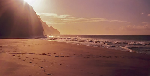
Pentax K-5, Vivitar Komine 28mm f2.0 Close Focus Wide Angle: A01 ( for those legacy lens collectors) Programmable interval timer, tripod.

Thursday, April 7, 2011

The Na Pali Coast

.Kalalau Beach
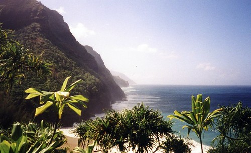
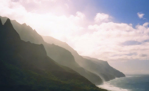
Most photgraphic adventures probably don't start out with a story about a woman, but this one will. I met Kristi at Theatrikos Theatre Company in Flagstaff, where she was working as the box office manager. I had been volunteering there for many years before, and had recently returned from a four year hiatus. After graduating from NAU school of performing arts, I had to get a job in the real world, but I missed the theatre. I met the executive director of the Theatrikos at the Zane Gray Ballroom, a bar upstairs in the Weatherford Hotel in downtown Flagstaff. We immediately hit it off, and shortly after I became the resident sound designer. Kauai'i  Jungle
I was cast in some plays, and became heavily involved in a rennovation project in the basement, building much needed dressing rooms. Kristi Long wanted to help build. My Dad, Johnathan, Kristi and I worked toghether for a few months. I began to notice and appreciate Kristi for her qualities, and attractiveness. Shortly after I was elected President of the Board of Directors, and became even more heavily involved in the theatre. A mutual freind, Sara Brecht, at some point thought we would make a great couple and decided to play matchmaker. She said to me; "I think Kristi likes you. You should ask her out." She said to Kristi; "I think he likes you, you should go out with him." Well, I did, and she did. We both dated a couple of months and (here it comes) she invited me to go with her to Hawaii to meet up with her brother. She warned me the major part of the trip would be hiking the Na Pali Coast's Kalalau Trail. Na Pali Seascape 2
I was no stranger to backpacking, as I was a Boy Scout, and kept backpacking through college with my good friend Rich Hoffman. Even though we bought the plane tickets at separate times, we managed to get the same flight out of Phoenix. I was able to sit next to her on the flight by trading seats with another passenger, saying to them we were on our honeymoon. He he. We arrived in Honalulu, and had to switch carriers to get to the island of Kauaii.Somehow Kristi had a first class seat on this empty plane, so she got to sit in the front row and drink free alcohol. I had to sit directly behind her and be content to eat dry peanuts. We met up with her brother at thier dad's time share, and went out for Chinese food with a Hawaiian twist (ala pork and pineapple) for dinner. I realize this is turning out to be a memorir, but with out content, there really is no blog. Plus it's always nice to have something to look back and read about what I did ten years ago. Anyway we packed up our backpacks, rented some snorkeling gear (which we never did use on the hike) and set out in the rental car to the trail head. If you have never been to Kauaii, you wouldn't know that on this island the road doesnt circumnavigate the island. The road ends abruptly at the trail head, since the terrain becomes increasingly rough. By rough I mean it is reduced to giant steep hills that differ hundreds of feet in elevation, right along the coast line. Na Pali Coast Mist 2
It's these hills that make it most interesting both for the hiker and photographer. The parking lot was not more than a grassy field populated by homeless chickens. Yes chickens. Aparently the chickens have escaped their barnyard due to the many hurricanes that hit the island, setting them free. The hike began as most hikes, and we made it to Ke'e beach (2 mi) without much trouble. The beach is a popular day hike for most tourists, and once you've left the beach they begin to thin out. Plus the trail immediately switch backs up about 800 feet. We kept hiking for four more miles through the jungle. We pitched camp at what we called the "Mosquito Camp," and had dinner. I think the mosquitos had more to eat than we did. The next day, the weather dried out a bit, and we were blessed with sweeping views up the coastline. The trail continued up and down, along cliff faces, and through valleys. The video I made does a better job conveying the harrowing trail looming over the crashing surf than I can describe: We spent the next couple of days at Kalalau beach, exploring the various waterfalls, and camping
We went in the winter, during the highest surf and strongest riptide season, so we didn't get much snorkeling in. Actually we didn't get any snorkeling in. We packed the kit we rented in and out, for nothing. At least the camera and video camera were put to good use. I'm all for stripping down and bathing in large pools, or sitting in hotsprings, but I wouldn't consider my self a nudist. There were nudists there that refused to compromise thier tan by wearing so much as a hat. We called him naked man. He was friendly, and hairless, and very tan. He apparently had no problem interacting with other campers, and was perfectly comfortable ingaging in conversation. I guess if he was comfortable, we would have to be comfortable. You know the type. There is always a naked man at these far reaching locales. I have yet to see a naked woman with such brazen conviction. Anyway we had to start heading back. Kristi's brother Kevin, and his girlfriend Chrissy had a little more time and stayed a few more nights, but we moved on. The return trip ended the first night at a camp we called "Cliff Camp." We had a choice of camping on a flat spot right on the edge of a cliff. There were some other campers close by at an adjoining cliff camp spot. We started to pitch our tent, then the heavens opened and began a deluge. We could see the cloudless sky and blue water just a few hundred feet off shore, but the rain comes from inland and swirls down off the mountain tops drenching to just off the shoreline. We quickly struck camp and headed for the protection of the jungle.
Tall Falls

The canopy only gave us a few minutes to get the tent up and tarp over the tent before it flowed like tiny creeks on the ground. We cooked dinner under the tarp that we made into a make shift vestibule. Even though it was raining it never really cooled off. Damp and tired we fell asleep with the rain pounding the top of the tent. About midnight we heard some rustling of pots and pans outside. A half an hour later we heard it again, then some scuffling inside the tent. Just about that time Kristi woke up with a giant rat scampering on top of her and over me. We were all shocked, rat included. We zipped up the tent after that. The rest of the trip was relatively dry. Some other interesting event that happened on the trail was when we saw drips of blood. We followed the blood trail for a half an hour and thought somebody was in bad shape. We came upon a girl who was crying and holding her nose. We asked if she needed help, and what happened. Apparently she slipped and landed nose first on a yucca spine, which went up her nose and peirced her sinus lining. Yikes. Not much first aid we could render there. She just asked us if we saw her friends to let them know she'd be delayed. We finished the remainder of the hike, took some photos at the end and continued back to the hotel high on life. This was our first epic hike together and quickly we became closely bonded. This was ten years ago in November of 2000. We were to have many more adventures and many more critters in the tent. Shortly after this trip I got a digital camera, and my 35mm gear went into hiding for a while.

Tuesday, April 5, 2011

WELCOME TO ALPINE IMAGING


WELCOME TO ALPINE IMAGING. (Formerly Agassiz) This blog was created for the purpose of announcing upcoming events, reporting, on past events, and describing the various photographic methods and undertakings of Agassiz Imaging. Photography is a journey where it's not the destination that is the key it's what you find on the way that is important. This is my journey, so there will be more than just the end result. There will be my life on the way.
ABOUT THE NAME Agassiz Imaging was coined from the most prominent peak seen from Flagstaff, on the San Francisco Peaks. Agassiz Peak, the second highest in Arizona sits, at 12,356 feet above sea level, can be seen as far away as 75 miles. The peak itself was named from naturalist, zoologist, and geologist Louis Agassiz, a Harvard professor (1807-1873). An ancient glacial lake in the Great Lakes area, Mount Agassiz in California's Palisades and Uinta Mountains, as well as the street a block from my house are also named after him. ABOUT THE PHOTOGRAPHER From an early age, Wade has been interested in photography. His father owned a camera store in downtown Flagstaff during the 80s called the Camera Corral, found on the corner of San Francisco and Leroux streets. Wade's first SLR was a Fujica, but a short time later aquired a Pentax Program Plus with a 50mm, and 28mm primes, and two Access zooms. Since then he graduated from NAU with a Bachelors of Arts from the School of Performing Arts, and has been combining his love for the outdoors and travel with his enthusiasm for photography. From the Na Pali Coast to the High Sierras, from Puget Sound to Mexico, he has produced images that continue to inspire an appreciation for nature. His awards includes 3rd place in the Coconino County Fair for the Old North Church in Winter and acceptance in to the Pentax Photo Gallery. His current line up still includes the Pentax Program Plus 35mm SLR, Pentax K200D, and Pentax K5 DSLRs. Also in the mix are various primes, zooms and fisheyes, as well as a Canon S80.